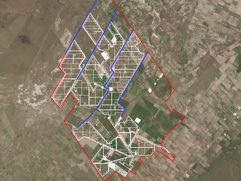
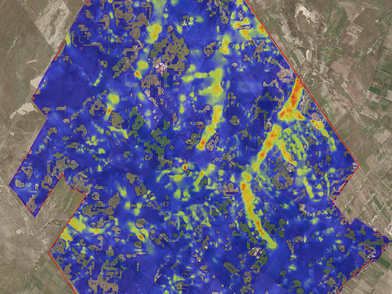
Location: Puebla, Mexico
Services provided: Hydrological Survey and Risk Assessment
Year: 2018
Description: The hydrological survey consisted of the analysis of the potential flood risk of a solar plant due to the increase in the flow of three channels that originated within the plot under assessment. Events with different probability of occurrence (25, 50, 100 and 200 years) that were obtained from the statistical analysis of the maximum daily rainfall recorded near the study area were analysed. To estimate the maximum flows of each channel and build a two-dimensional model of the movement of surface runoff water (storm and river). Following the CONAGUA (National Water Commission of Mexico) criteria, different methods of converting rain into runoff were compared, such as the Curve Number (SCS), the Triangular Unit Hydrograph (TUH), the Ven Te Chow and the American Rational Method. Finally, with the results obtained, drains were designed to evacuate excess water within the study area.


