
Location: French Guyana, France (South America)
Services provided: Hydrological Survey, Risk Assessment and Erosion Analysis
Year: 2019
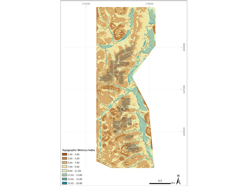
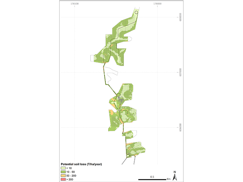
Description: The hydrological survey consisted of the analysis of the potential flood risk for a solar plant project for 7 return periods (2, 5, 10, 20, 50, 100 and 200 years). The study area was located in a tropical rainforest with very gentle slopes and rainfall of more than 2000 mm per year. The study analysed the maximum rainfall series in the area, obtained from the French Meteorological Service (Météo France) and applied the rainfall-runoff methodology of the Curve Number of the Soil Conservation Service (SCS-CN) to obtain the design hydrographs and develop the hydraulic flood models. Based on this information, maps of the flood zones were made based on their danger to the different proposed infrastructure (e.g. panels, electrical substation, roads, and access roads) and humans. In parallel, water erosion was evaluated using the Universal Soil Loss Equation (USLE), recognized bythe FAO to analyse the phenomena of soil loss due to surface runoff. Finally, the study presented the drainage system design together with proposals to reduce erosion levels in slopes and areas with high slopes.


